Quick Summary
Millions of pets go missing each year, and traditional search methods often fall short. Drones equipped with thermal imaging, night vision, cameras, speakers, and signal relay tech are transforming pet rescue by expanding search areas, detecting heat signatures, and improving safety and speed. While drone technology in pet rescue has limits – like noise, vegetation, weather, and terrain – they work best when combined with owner knowledge, community support, and traditional recovery tactics to reunite pets with their families faster.
Introduction
The statistics paint a sobering picture of pet loss in America. According to Pet911.org‘s comprehensive survey, approximately 1.7 million pets went missing across the United States throughout 2024.
The breakdown reveals that dogs accounted for 72% of these cases, cats represented 20%, and other animals – including birds at 49% of that category, along with exotic pets like goats, miniature pigs, lizards, and chameleons – made up the remaining 8%. What’s particularly heartbreaking is that only 63% of lost dogs and 52% of missing cats were successfully reunited with their families.
These numbers underscore an urgent need for more effective pet recovery services and innovative lost pet help technologies.
For countless families, pets aren’t just animals – they’re beloved fur babies and irreplaceable family members. When a pet goes missing, the emotional toll drives owners to seek every available resource for pet location assistance.
The pet rescue landscape has traditionally been divided into two main categories: paid commercial pet recovery services and volunteer-based non-profit organizations staffed by dedicated animal lovers. As Reddit user geeered documented regarding the United Kingdom’s extensive network of support organizations, this global community of volunteers provides crucial support to the rescue operations that complement professional services.
The Limitations of Traditional Search Methods
Conventional approaches to finding lost pets have relied heavily on social media announcements, collaboration with animal welfare organizations, and creating familiar environments near the disappearance site using scent markers, food, and routine-based cues. While these methods have helped reunite some families with their pets, they face significant constraints that modern technology can address.
The first major limitation involves the inability to conduct three-dimensional environmental assessments of the missing area. Ground-level searches operate from a two-dimensional perspective, inevitably creating blind spots where frightened or injured animals might hide undetected.
Second, information dissemination through traditional channels requires precious time – time that could mean the difference between life and death during the critical golden rescue window when a pet’s survival quality hangs in the balance.
Third, unpredictable weather conditions can severely hamper rescue efficiency, further compressing that vital timeframe when conditions are optimal for both search operations and the pet’s survival.
Revolutionary Technology: Pet Search and Rescue Teams Introduce Drones
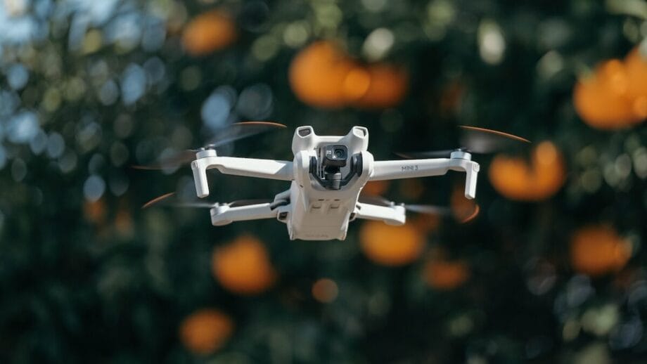
The integration of unmanned aerial vehicles into pet safety drone help operations represents a paradigm shift in how we approach animal recovery. Modern pet rescue aerial equipment focuses primarily on new-generation drones equipped with UAV thermal imaging cameras mounted on advanced gimbal systems. These sophisticated tools have transformed what’s possible in search operations, particularly in complex and potentially dangerous environments.
Consider the environments where pets often become lost: dense forests with thick undergrowth, steep mountainous terrain, areas near bodies of water, or locations with unknown risks. Even when personnel are equipped with adequate equipment and sufficient psychological preparation to wade through dangerous waters and venture into risky areas, they may not be able to comprehensively consider the actual situation in hazardous zones. A single misstep could endanger rescue personnel’s lives and safety.
Therefore, the large-scale application of drones in pet search and rescue undoubtedly represents conducting a complete risk assessment for rescue decision-making and rescue process control, making search and rescue more relaxed and orderly while reducing unnecessary risks.
Real Stories: When Drone Technology Saves Lives
The following case experiences validate the effectiveness of drone technology in pet rescue operations.
Let me share Ted’s experience with rescuing a small cat.
On a frigid winter morning, Ted deployed his drone equipped with a visible light camera to search for a missing feline. Flying methodical patterns over the snow-covered search area, the drone’s camera successfully tracked the small cat’s paw prints in the snow. This aerial perspective allowed Ted to trace the cat’s path efficiently, significantly reducing the walking distance for ground search and rescue personnel.
Without the drone’s capability for spying with a drone from above, those crucial paw prints might have been trampled by searchers or obscured by new snowfall, making the ground search exponentially more difficult and time-consuming.
Karen’s story demonstrates another dimension of drone-assisted pet rescue coordination.
Karen temporarily hired a qualified pilot to operate a thermal drone search aircraft. Working alongside her friend Elvis, they implemented a strategic approach combining aerial technology with traditional methods. They established food and water stations at key locations, creating fixed and familiar spots designed to encourage the pet to return to a specific location for reunion with the owner.
The systematic combination of thermal imaging surveillance and strategically placed comfort stations ultimately led to a successful recovery.
Advantages of Drones in Pet Rescue

1. Infrared Imaging Cameras Can Detect Living Animals
The cornerstone of modern drone-based pet recovery services lies in UAV thermal imaging camera technology’s ability to detect living animals through their infrared activity range, providing crucial information about the survival status of pets and animal groups. Infrared thermal imaging technology operates on a fundamental principle: infrared sensors can sensitively identify heat emitted by objects.
This heat transfer and variation consists of infrared electromagnetic waves of different spectral wavelengths working together. Animals and pets necessarily possess body temperature, and temperature dissipation occurs in the form of infrared wavelength bands. Therefore, infrared thermal imaging can sense the presence of this temperature.
When rescue personnel operate large display screens, they observe false-color imagery where the background environmental temperature contrasts with living body temperature. This contrast enables operators to judge the situation of living bodies within concealed objects. According to some research, temperature fluctuations in certain animals may indicate disease conditions within the animals themselves.
Different pets correspond to different temperatures, primarily divided into warm-blooded animals (birds and mammals) and cold-blooded animals (lizards and snakes):
Temperature Reference Table:
| Metric | DOG | Cat | Metric | Reptiles |
| Normal Body Temp | 99-103°F (Avg 102.5°F) | 100.5 – 102.5°F | Normal Temp | Avg 65-85°F |
| Hyperthermia (Fever) | > 106°F | > 102.5°F | Basking Temp | 90 – 110°F |
| Hypothermia | < 98°F | < 100.5°F | – | – |
Reference: Hypothermia in Dogs: Signs and Treatment, Understanding Fever in Cats.
2. Visible Light Lenses Provide Overhead Views of Geographic Environments
Drones with cameras equipped with visible light lenses can provide overhead views of the specific geographic environment where animals are lost, transforming the field of vision into a three-dimensional perspective.
Generally, personnel conducting search and rescue can only observe vegetation obstruction and natural landscapes directly ahead in a two-dimensional manner, which easily creates blind spots in certain viewing angles. The coordination between the unmanned aerial vehicle perspective and rescue personnel makes the observation range significantly broader and more comprehensive, enhancing the effectiveness of UAV aerial inspection operations.
3. Professional Drones Feature Speaker Systems for Communication
Professional pet rescue aerial equipment is equipped with speaker systems that enable rescue personnel, animal psychologists, and owners to issue commands and emit specific frequency sounds to seek responses from their beloved pets, thereby determining approximate distance.
Some research indicates that certain animals’ auditory nerves can identify sound frequency ranges that humans cannot hear. Some frequency ranges can stimulate animal reactions, while other frequencies can soothe the emotions of fur babies and beloved pets who are in states of mental tension and emotional distress.
Hearing Frequency and Response Table():
| Features | DOG | Cat | Human | Lizards |
| Audible Frequency Range | 40Hz – 40,000Hz+ | 30Hz – 60,000Hz | 20Hz – 20,000Hz | 200 – 4,000 Hz |
| Calming Frequency | Mid-low / 50–90 bpm | 20–30 kHz | – | 200 – 800 Hz |
| Defensive Alertness | High Freq (3kHz~8kHz) | High Freq (3kHz~8kHz) | – | 2,000 – 5,000 Hz |
Reference: Can Dogs Hear Better than Cats?, Temperature and Humidity Monitoring for Pet Reptiles and Amphibians.
Understanding what frequencies drones use for their own operations versus what frequencies effectively communicate with different animal species allows rescue teams to deploy targeted acoustic strategies that maximize the chances of eliciting responses from lost pets.
4. Signal Coverage Enhancement in Areas with Insufficient Signal
Some professional unmanned aerial vehicles can cover areas with insufficient signal coverage, enhancing the transmission of search and rescue information. Some pets may be lost in locations such as the back slopes of mountains. When drones fly over these positions, signal insufficiency may affect observation capabilities. Signal relay networking technology can effectively solve this problem, ensuring that thermal drone search operators maintain real-time contact with ground personnel even when searches extend into remote areas with poor cellular or radio coverage.
5. Low-Light and Starlight-Level Cameras for Dim Environments
Drones with night vision technology equipped with low-light or starlight-level photosensitive cameras can conduct photography and observation in caves with weak light at close range, or during dusk and dawn moments when ambient light is minimal. These specialized sensors extend the effective search window dramatically, allowing operations to continue in conditions where human vision would be severely compromised. This capability proves particularly valuable when searching enclosed spaces, dense vegetation areas, or conducting operations during twilight hours when many animals become more active.
Limitations of Drones in Pet Rescue

1. Propeller Noise May Increase Animal Anxiety
While drones bring convenience to rescue personnel, rescue personnel and organizations cannot ignore problems that unmanned aerial vehicles may not fully address. The high-speed rotation of drone propellers produces relatively high-frequency sounds, which may potentially increase animals’ anxiety and consume their survival energy. According to certain research findings, the acoustic signature generated during UAV aerial inspection operations can trigger stress responses in already frightened animals, potentially causing them to flee further or remain frozen in hiding rather than responding to calls.
Reference: Drones & Pets: A Guide to Peaceful Coexistence.
2. Vegetation Density Affects Thermal Imaging Effectiveness
Drone thermal imaging photography is significantly affected by ground vegetation density. The denser the vegetation and the thicker the concealment objects, the more likely it is to reduce thermal imaging contrast and affect observation acuity. Dense canopy layers or thick undergrowth can absorb and scatter infrared radiation, making it difficult for drones with IR cameras to detect animals hidden deep within vegetated areas. This limitation requires operators to focus searches on clearings, forest edges, and areas with less dense coverage.
Reference: Drones and Lost Pet Recovery: How Effective Are They?
3. Weather and Temperature Conditions Impact Thermal Imaging
Weather conditions during search and rescue operations significantly affect the effectiveness of UAV thermal imaging camera performance. In spring and autumn seasons, when day-night temperature differences are larger, and animal temperatures remain relatively constant, it becomes easier to lock onto pet locations. The thermal contrast between warm-blooded animals and cooler backgrounds creates clear signatures. However, in summer, when environmental temperature day-night differences are smaller compared to constant-temperature animals, the contrast difference makes it considerably more difficult to lock onto pet positions. Professional operators must plan their flight schedules around these thermal cycles, conducting searches during periods of optimal temperature differential.
4. Special Terrains Pose Operational Hazards
Some special terrains and geographic meteorological phenomena make it difficult for unmanned aerial vehicles to penetrate deeply or operate safely. These include swamps, dark ditches, culverts, areas around volcanoes, and avalanche zones. Additionally, caves containing flammable gases or areas with magnetic mineral deposits may lack sufficient signals for stable flight operations. The frequency at which drones are used for control becomes critical in these environments, as electromagnetic interference can cause wing operations to become unstable, causing drones to lose stability and balance, making them prone to crashes. These environmental constraints require careful pre-mission assessment and may necessitate alternative search methods.
Best Practices: How to Effectively Use Drones in Pet Rescue Operations
To maximize the effectiveness of pet safety drone help operations while managing the limitations discussed above, rescue teams should implement the following professional protocols:
- Operators must be thoroughly familiar with their drone’s endurance capability, flight distance, and image transmission distance parameters to make sound, overall balanced decision-making and expectation management. Understanding these specifications prevents mid-mission failures and ensures searches remain within safe operational parameters.
- Perform regular gimbal lens maintenance to reduce damage and maintain optimal photography performance levels. The quality of thermal and visible imagery directly impacts detection success rates, making equipment maintenance a critical component of professional pet rescue aerial equipment operations.
- During search and rescue processes, if the drone encounters sudden situations, operators should immediately record the situation location and execute smooth landing procedures to avoid crash risks. The temptation to push through problems must be weighed against the risk of losing the drone and its capabilities entirely.
- Conduct systematic environmental ecological surveys of the search and rescue area, including comprehensive terrain and landform assessments and meteorological condition investigations, to avoid taking aggressive flight approaches that could endanger equipment or compromise mission success.
- When encountering sudden drone operational issues, promptly prepare backup aircraft and other emergency equipment support to ensure search operations can continue without extended interruptions.
- When necessary, maintain communication with the drone manufacturer’s technical support teams to access comprehensive technical support solutions and troubleshooting expertise.
- Stay current with the FAA’s latest laws and regulations, conducting ongoing learning of flight skills and theoretical study of legal requirements. Professional drone operators for pet rescue must maintain appropriate certifications and ensure their operations comply with all applicable aviation regulations.
Important Reminder: Drones Are Supplementary Tools, Not Complete Solutions
Therefore, it’s crucial to note here again: drones are not the only means for finding lost pets; they represent one supplementary method to traditional search and rescue approaches. The most successful pet recovery service operations integrate drone technology with comprehensive strategies that include owner involvement and community support.
What Owners Should Do:
Pet owners play irreplaceable roles in recovery efforts and should take the following actions:
- Recall the animal’s daily activity preferences and establish feeding stations or create familiar environments in the lost area. These anchor points often draw pets back to locations where they feel safe and comfortable.
- Share information through social media and find platforms with followers in other animal-loving communities, encouraging widespread attention to the animal’s movement trajectory and potential sightings.
- Provide more detailed pet information to search and rescue organizations and consult with professionals who have extensive search and rescue experience. The more complete the information, the better rescue teams can tailor their approaches.
- For pets equipped with GPS positioning chips, utilize the positioning information to comprehensively determine location and narrow the search area for drone operations.
- Search and rescue operations can utilize life detection instruments to detect changes in animals’ and pets’ breathing and scent, complementing the thermal imaging capabilities of drones with IR cameras.
Conclusion

The integration of unmanned aerial vehicles with UAV thermal imaging cameras, drones with night vision capabilities, and sophisticated communication systems has revolutionized pet rescue operations. These technologies provide capabilities for lost pets to the rescue that simply didn’t exist before – the ability to conduct comprehensive UAV aerial inspection of vast areas quickly, detect hidden animals through thermal signatures, and operate effectively in challenging conditions.
Yet technology serves best when deployed thoughtfully, with full awareness of both its ten critical advantages and limitations. The most effective pet location assistance operations recognize that finding a lost pet requires not just sophisticated pet rescue aerial equipment, but also systematic planning, owner knowledge, community involvement, and genuine compassion for reuniting beloved fur babies with the families who miss them.